BMWMCOGA 5 Corners Challenge
The objective of this Challenge is to ride to the five corners of Georgia and
through two via's within a continuous 48 hour period.
This page describes each of the Five Corners and two Via's to help you easily
identify the required stops! It is suggested that you print out this page along
with the pictures to be sure you are at the correct stop. The GPS Coordinates are
within sight of each location.
The coordinates furnished here are approximate! They are within 500 feet
of the designated location. These coordinates are using the following
grid/datum setting: Photo of your bike with corner feature/location in background will document your visit to that corner.
Grid = hddd° mm.mmm
Datum = WGS 84
|
Vias: Columbus and Augusta - Must secure printed receipt at vias to document via travel.
|
|
|
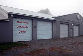
New Home in the NW corner
N34° 58.289 W85° 32.595
From I-59, Exit 17, Slygo Road, travel west on Slygo Road (CR 200) for 1.80 miles
to a "T" intersection. Turn left at the "T" intersection, staying on CR 200, and
travel 1.71 miles to CR 202. Turn right onto CR 202 and travel 0.66 miles to a "Y"
intersection. Take the left hand road, Ballard Road, and stay on Ballard Road for
3.10 miles to New Home. There are few structures in New Home! Look for the
volunteer fire department and community center as pictured here.
|
|
|
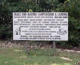
Trails End Marina Sign at the SW corner
N30° 48.023 W84° 55.227
Starting in Bainbridge, Georgia look for GA County Road 253 running south west
from US 84 and US 27 on the west side of Bainbridge. Travel west on GA 253 through
the small settlements of Bethany and Reynoldsville for approximately 22 miles to
the end of the road, mile marker zero. Look for the "Trails End Marina" sign as
pictured here.
|
|
|
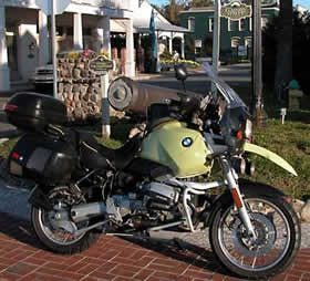
St. Marys at the SE Coastal corner
N30° 43.219 W81° 32.918
St. Marys is located off I-95 at Exit 1 or 3 depending on your direction of
travel. Simply ride into town and look for the sign located at the foot of
Main Street in Historic St. Marys, GA.
|
|
|
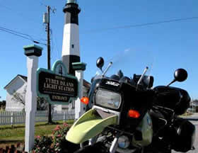
Tybee Island at the NE Coastal corner
N32° 00.510 W80° 50.563
From Savannah, Georgia take US 80 to Tybee Island. The Tybee Island Light
Station is a major tourist attraction on the Island. The Light Station is
pictured here.
|
|
|
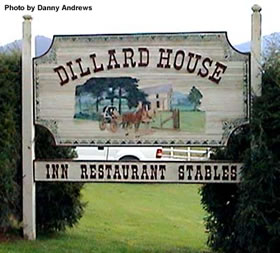
Dillard, Georgia at the north east corner
N34° 58.210 W83° 23.215
Dillard is located on US 441/23 just south of the Georgia/North Carolina border.
The Dillard House sign is the photo requirement for this stop. The Dillard house
Restaurant sign is very prominent standing in front of the restaurant.
|